


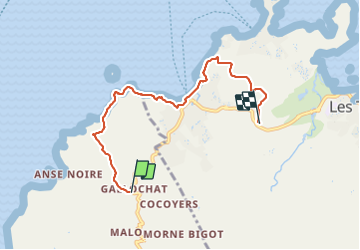
Galoche - Esperance

Lamartiniere
User GUIDE

Length
7.8 km

Max alt
197 m

Uphill gradient
233 m
Km-Effort
11.2 km

Min alt
0 m

Downhill gradient
304 m
Boucle
No
Creation date :
2021-06-03 12:20:08.086
Updated on :
2021-06-03 16:15:20.656
3h20
Difficulty : Medium

FREE GPS app for hiking
 SityTrail
IGN / Geographical institutes
SityTrail Plus
The world is yours!
About
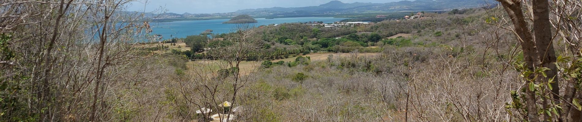
Trail Walking of 7.8 km to be discovered at Martinique, Unknown, Les Anses-d'Arlet. This trail is proposed by Lamartiniere.
Photos


Positioning
Country:
France
Region :
Martinique
Department/Province :
Unknown
Municipality :
Les Anses-d'Arlet
Location:
Unknown
Start:(Dec)
Start:(UTM)
707360 ; 1606603 (20P) N.
Comments